The DmD 2018 Tours
Contrary to the DMD 2017 we offer in Tarrenz many different tours for the participants. The range of the guided tours is from cozy, less demanding but culinary fun trips up to sportive high mountain tours designed for ambitious drivers. According to your interests and driving styles choose your tours.
To choose the right tour for you, we will be happy to help you at the Info Desk. Please inscribe for your tours on Wednesday at the info desk.. The maximum group size on the tour should not exceed 10 bikes.
Please be on time at the agreed start time at the meeting point.
Of course, you also have the opportunity to discover the area by yourself. Also for this you can use the offered tour suggestions.
These are expected to be available for the download at the end of April 2018 on this website.
Note:
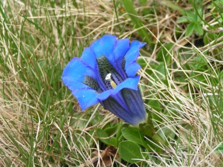
On nearly all tours we are temporarily riding through areas with high evaluations. Particularly in this alpine areas you has to take care of animals and there “traces” on the roads.
The regulatory authorities are also very active and prefer to use laser guns. Please always adhere to the indicated restrictions.
Tour A - Comfort
Length: 149km / Driving time: approx. 3h / Difficulty: easy
A short half-day tour without great driving challenges.
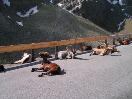
Nevertheless, this round offers charming experiences and beautiful views. It is worth to mention the Kühtaisattel with its animal world. Attention, it is most likely that cattle, sheep and horses are on the streets.
Later we will have a look at Innsbruck. A trip to the city is worthwhile. We will ride via smaller roads, always on the edge of the Inn valley, back to Tarrenz.
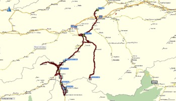
- Click on the image to see a map (pdf) with the tour
- Download the gpx-file
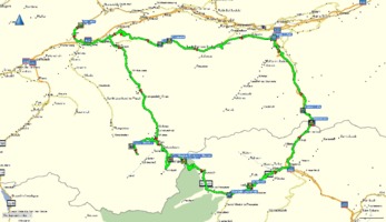
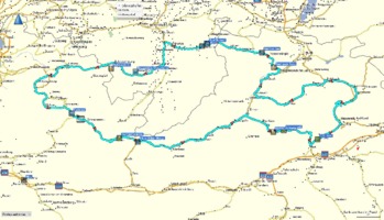
Tour B - Kaunertal / Reschen
260km / approx. 5 hours / medium
A tour with many highlights.
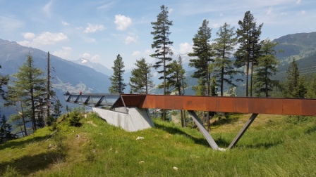
First we reach the viewing platform "Gacherblick" at the Pillerhöhe. Here we have a breathtaking view of the Inn valley. Afterwards we will ride to the Kaunertal and on the Kaunertal Glacier Road (toll 14 €) to the Weißseeferner. This is real “high mountain”!
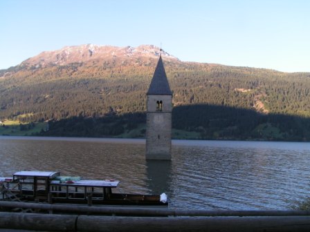
After the glacier, we will ride in direction to Italy. Via the Fernmünzpass and the Reschenpass, we reach the Reschensee with its famous church tower inside the lake. We ride around the lake and start our way back to Tarrenz.
Possibly you would like to take a small detour into the Swiss customs area Samnaun with excellent shopping possibilities, to take some fuel will be a good idea also.
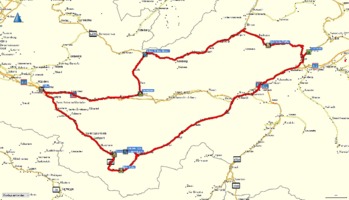
- Click on the image to see a map (pdf) with the tour
- Download the gpx-file
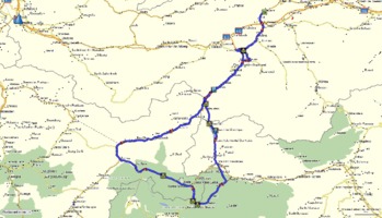
Tour C - Silvretta
240 km / approx. 5 hrs / easy
A tour with many highlights.
The place Galtür attained very sad fame in 1999. In February, one of the biggest avalanches in Austria's history took place.
The Silvretta-Hochalpenstrasse (toll road 12 €) is one of the best-developed high alpine routes. Here is it also worth to ride a short detour to the lake Kops.
A stop at the location “Bielerhöhe” is more or less mandatory. If you like, some sweet surprise is waiting for you in Bludenz.
Flexenpass and Hahntennjoch are the next highlights before we return to Tarrenz.

- Click on the image to see a map (pdf) with the tour
- Download the gpx-file
Tour D - Timmelsjoch
290km / about 6 hours / medium – challenging
On this tour we reach the highest areas.
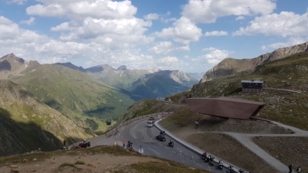
If you like you may take a detour over the Ötztaler Glacier Road (tolls € 5.50 / € 9.50) to the highest point in the Alps, you can go to on asphalted roads. The next peak is not far away, the “Timmelsjoch”.
At the toll station (toll 14 €) a motorbike museum is situated. A stop at the pass is mandatory.
We will cross the Jaufenpass to the famous Brennerpass. But we will not ride over the highway, we prefer the smaller old Brenner-Road.
Just before we reach Innsbruck, we turn left and drive via Kuhtai again back to Tarrenz.
- Click on the image to see a map (pdf) with the tour
- Download the gpx-file
Tour E - Stilfs
285km / about 5 hours / challenging
This tour takes us to one of the most famous alpine routes.
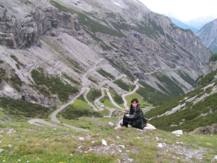
It is said, that the Stelvio is one of these alpine passes every motorcyclists should cross once in a lifetime. First, the tour takes us over the Pillerhöhe and along the Reschensee to Glurns. This is the start of the east ramp of the Stelvio Pass.
But be careful, there are always a lot of cyclists on the road. Consideration must be the first bid!
Compulsory program at the pass: “Bratwurst mit Kraut”! After the refreshment we will go to Switzerland and will ride over the Umbrail Pass and Ofenpass into the Münstertal.
On the way back to Tarrenz you may take a short detour to Samnaun.
- Click on the image to see a map (pdf) with the complete tour
- Download the gpx-file
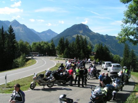
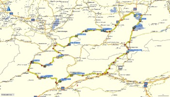
Tour F - Oberjoch / Riedberg
265km / approx. 5 hours / easy
On the tour to the highest pass in Germany.
The tour takes us first over the busy “Fernpass” Shortly afterwards we turn into the wonderful Namlostal and follow the river Lech, along the Haldensee and follow the road to Oberjoch in Germany. From there the tour brings us over Sonthofen to the highest pass of Germany, the Riedbergpass.
Almost unnoticed short behind Balderschwang we have arrived back in Austria and drive via Hochtannbergpass and Hahntennjoch back to Tarrenz.
- Click on the image to see a map (pdf) with the complete tour
- Download the gpx-file
Tour G - Seerunde / Namlos
240 km / approx. 4.5 hrs / easy
Away from the mainstream
This tour use mostly small roads which are away from the large tourist streams. This will be a relaxing round trip without climbing to very high heights.
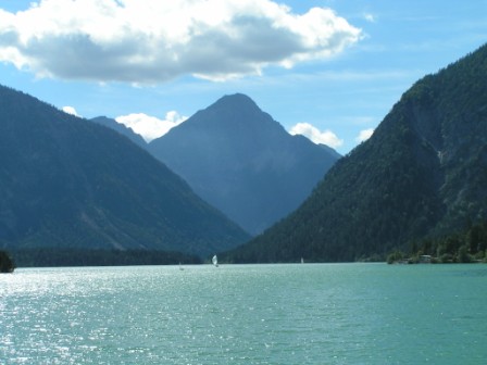
On our trip we pass the Walchensee, the Kochelsee, the Ettal Abbey and the Plansee, and riding through the picturesque valley Namlostal we reach the Hahntennjoch. From there it is not far to Tarrenz.
- Click on the image to see a map (pdf) with the tour
- Download the gpx-file
Information on all tours
- Download gpx-file with all tours
- Downlaod the complete package (gpx & pdf-file) of all tours as zip-container
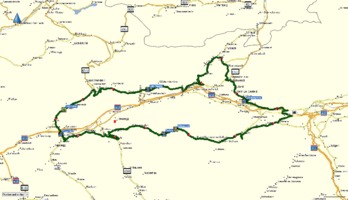
Route screenshots taken from Garmin® BaseCamp City Navigator Europe NT 2018.2®